Share via:
LANDSLIP remediation works are progressing across the Nambucca Valley, with two damaged sections of Welshs Creek Road now repaired and major works underway near Johns Bridge at Missabotti.
The repairs follow extensive geotechnical assessments, further reviews after subsequent flood events, and negotiations with government agencies to secure funding for the recovery program.
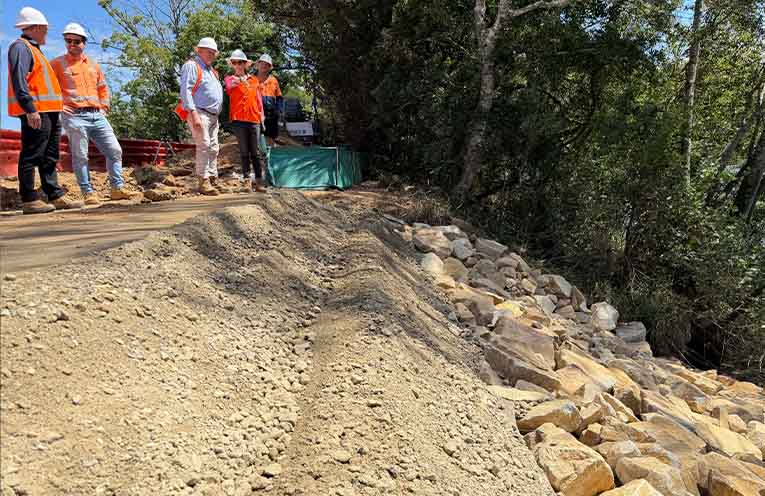
Nambucca Valley Mayor Gary Lee said it was encouraging to see the work now taking place on site.
“Two landslip sites along Welshs Creek Road, caused by flooding in 2022, have now been repaired using engineered rock fill over the past month,” Mr Lee told News Of The Area.
“This is excellent progress by the principal contractors Council has engaged to deliver the works and I am pleased action is happening.”
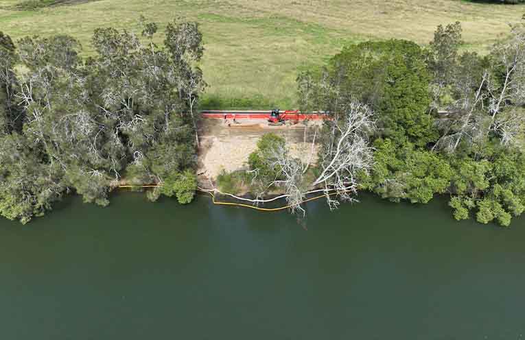
Last week the Mayor visited Johns Bridge at Missabotti, where workers have put in environmental controls and started installing the first steel sheet piles, intended to safeguard the rockfill works to come and then be removed after the rockfill is placed.
“There’s still a lot more work to go over the next two to three years to remediate up to 90 landslip sites across our valley,” Mr Lee said.
“I thank our community for its patience and compliance with traffic control instructions and traffic diversions, necessary to enable the work and ultimately make our roads safer.”
Further landslip remediation projects are scheduled to take place across several locations in early to mid-2026.
These include works at Piggot Street in Nambucca Heads, River Street in Macksville, Riverside Drive in Nambucca Heads, and Taylors Arm Road at Congarinni, Burrapine and Thumb Creek.
Repairs at the Taylors Arm Road landslip site located 4.7 kilometres west of Macksville are expected to be completed this week, weather permitting.
Additional works are also planned for Upper Buckra Bendinni Road at Buckra Bendinni.
Residents wanting to check whether remediation works are planned in their area can visit Nambucca Valley Council’s website and view the Disaster Recovery Interactive Map.
The map can be accessed online at:
https://experience.arcgis.com/experience/51cec82f0ba446faae64fe139ff6bf50
Council also encourages residents to download the Antenno mobile app, which provides notifications about road works and other activities occurring nearby.
Disaster recovery works across the Nambucca Valley are funded through the NSW Reconstruction Authority, with Council acknowledging the support of both the State and Federal Governments in funding the repair of essential public infrastructure.
You can help your local paper.
Make a small once-off, or (if you can) a regular donation.
We are an independent family owned business and our newspapers are free to collect and our news stories are free online.
Help support us into the future.
Share via:
