Share via:
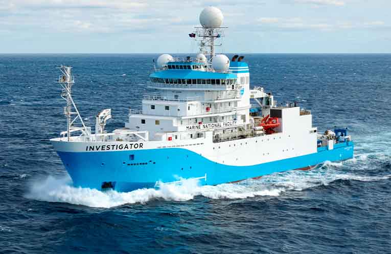
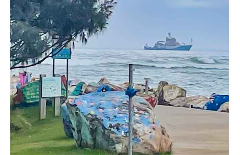
RESIDENTS of the Nambucca Valley were treated to an unusual sight last week when the RV Investigator, Australia’s advanced 94-metre ocean research vessel operated by CSIRO, appeared close to the coastline.
Large vessels are rarely seen this close to our near shore, generating curiosity across the community.
The CSIRO’s Marine National Facility advised that the vessel was in the region as part of a transit voyage from Brisbane to Hobart, making use of available sea time to deliver two significant underwater cultural heritage projects.
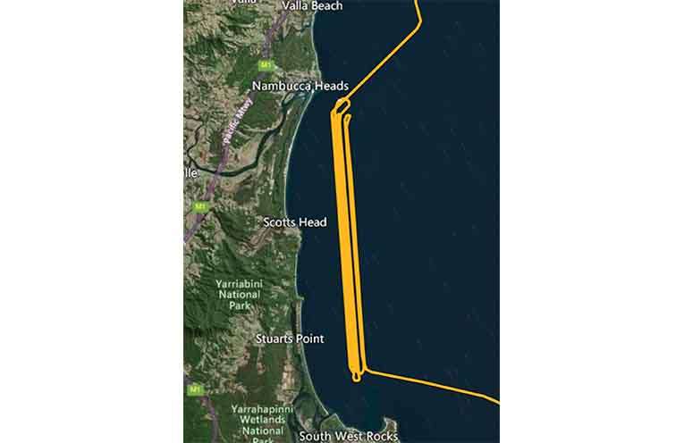
Off Nambucca Heads, the Investigator was focused on high-resolution seafloor mapping of submerged Indigenous palaeolandscapes associated with the ancient Macleay River system.
The area is of cultural significance to the Gumbaynggirr, Ngambaa and Dunghutti peoples.
These now-underwater environments once formed part of rich cultural areas occupied by these Traditional Custodians during periods of lower sea level.
The goal is to help link ancient songlines and cultural sites with offshore landscapes now hidden beneath the sea, contributing to reconstructions of past environments and climate.
This work forms part of a co-designed Sea Country mapping project involving Traditional Custodians and University of Adelaide co-chief scientist Dr Ania Kotarba, who were onboard to guide research off South West Rocks and Crescent Head.
Mapping data also connects with significant onshore cultural sites such as the Clybucca shell middens, helping to build a holistic picture of coastal change and deep-time Indigenous heritage.
Operating a 94-metre research vessel so close to the coastline is no simple task and the crew conducted a navigational assessment before departure, and the ship’s Master took advantage of near-perfect weather to safely run tight, parallel survey lines.
During their visit to the region the RV Investigator team faced challenges that included working within shallow water constraints, managing swell, currents and surf-zone proximity while ensuring coordination with Traditional Custodians to see that cultural protocols were upheld.
The data collected during the voyage contributes to a range of national research priorities.
It advances Australia’s ability to map and protect underwater cultural heritage, helping to build the frameworks needed for future heritage surveys.
It also deepens understanding of climate and environmental change by reconstructing past sea-level rise and coastal transformation.
The project strengthens Indigenous knowledge integration, supporting cultural revitalisation and long-term Sea Country stewardship through genuine collaboration with Traditional Custodians.
All mapping results will be incorporated into AusSeabed, Australia’s national seabed-mapping initiative, which forms part of the global effort to chart the world’s oceans by 2030.
Ngambaa Traditional Custodians played a direct role by identifying culturally significant areas during the voyage.
Post-expedition, findings will be shared with local communities through workshops and educational resources.
“Having RV Investigator off the Nambucca Valley highlights the significance of this coastline’s cultural and natural heritage,” Gaby Marino, Group Leader, Operations, Ship Management Program, Marine National Facility (CSIRO) told News Of The Area.
“The research honours Sea Country and creates opportunities for community engagement in marine science and cultural heritage.”
By Mick BIRTLES
You can help your local paper.
Make a small once-off, or (if you can) a regular donation.
We are an independent family owned business and our newspapers are free to collect and our news stories are free online.
Help support us into the future.
Share via:
